One of the features of older Chesterfield was the large number of long yards in the Market Place area. In this post we look at one of these survivors – Angel Yard which started in the Market Place and ran right up to Saltergate.
When the Crown officials, who had charge of the manor of Chesterfield, decided to move to a new and present market area, at the end of the 12th century, they also laid out burgage plots. On the Low Pavement and Central Pavement side of the market these went right down to the banks of the river Hipper. But, on the opposite side they were constrained by those already on Saltergate. Many had yards to access the properties that were built on them.
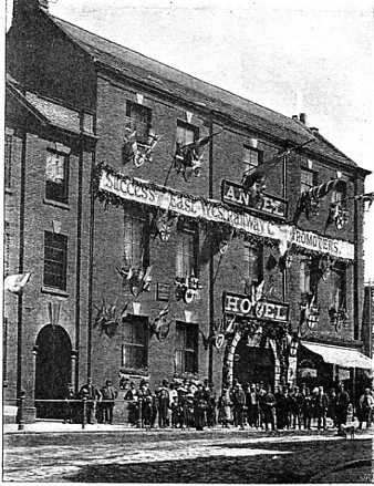
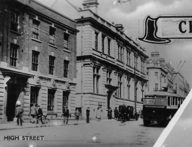
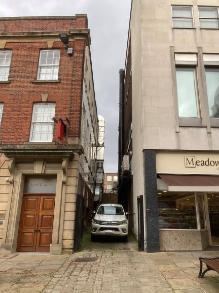
You can still see remnants of these plots and yards today. A traceable one is Angel Yard, which ran from the Angel Hotel on the Market Place, right up to Saltergate. Our first photograph shows the one-time Angel – decorated for the turning of the first sod of the Lancashire, Derbyshire and East Coast Railway in 1892. The archway to the right leads up to Angel Yard. Fast forward to the late 1920/1930s for our second photograph – complete with trolley bus. The Angel Hotel was burnt down in 1917, but had closed in 1915. The adjacent post office (which opened in 1886 after being in the Market Hall) took advantage by extending towards its next-door neighbour – the then Westminster Bank. Note the gap between the two – probably remnants of our Angel Yard. This gap is still there – our third photograph.
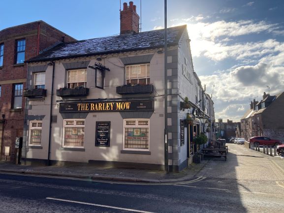
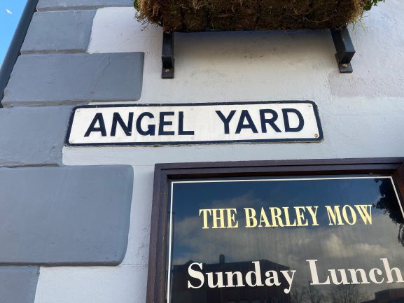
At Saltergate – our fourth photograph – next to the Barley Mow public house, Angel Yard still exists. You can still see it has a street name plate and it actually looks like a yard. It runs down towards its now isolated end in the Market Place, cut off by the relatively modern Rose Hill.
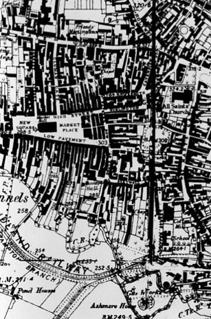
There are still other fragments of the burgage plots and their yards left – perhaps most notably on Central Pavement with Theatre Yard and Ward’s Yard. But many went when The Pavements shopping centre was developed at the rear of Low Pavement. A stark illustration of the former burgage plots can be seen on our seventh and final illustration – part of the 1883 Ordnance Survey 6 inches to 1 mile map of Chesterfield. Note the long black blocks of property – following the boundaries of the old burgage plots.
You can find out lots more in our Chesterfield Streets and Houses book.