
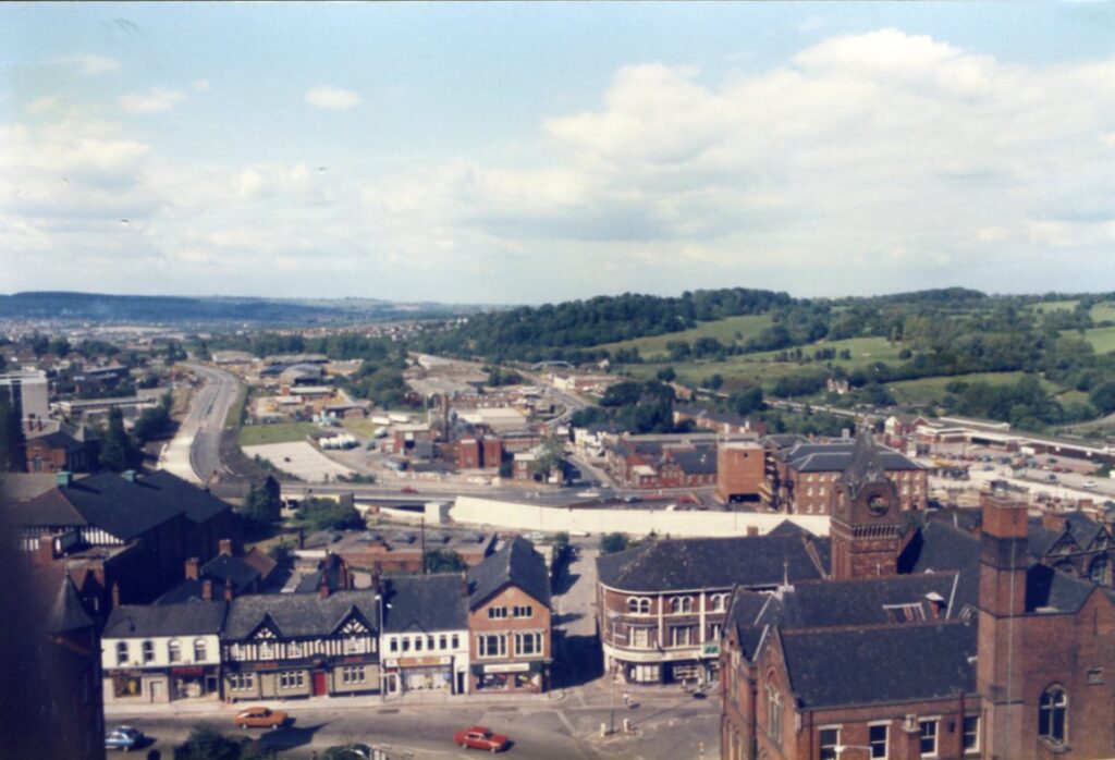
This June 1985 view of Chesterfield taken from the parish church tower shows a familiar, if changed, view. But it’s not the by-pass under construction snaking away to the top left, the now demolished Trebor (once the Chesterfield Brewery Company) premises (left of centre) or the soon to be demolished Chesterfield Hotel just behind the tower to the Stephenson Memorial Hall (right), that we are discussing in this post, but a rather more elusive building ‘The Pump House’.
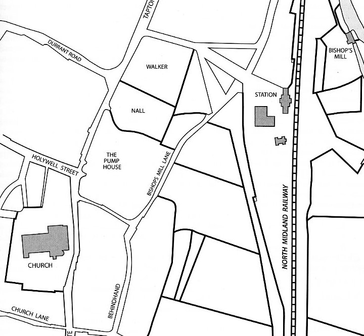
As the map extract from our Chesterfield Streets and Houses book shows, this mysterious property sat in the area to the right of Tapton Lane – which can be seen travelling down out of town, to the bottom centre of the photograph.
The house appears to have been built by a Marmaduke Carver (d. 1756). It’s not shown on William Senior’s 1633 survey of Chesterfield. Joseph Hunter mentions this house by name in his book Familiae Minorium Gentium (‘Families of the Lesser Gentry’). This may be the only place the name appears!
Marmaduke Carver married Ann Milward. One of their offspring – another Marmaduke – was town clerk of Chesterfield from 1711 to 1745. The house and its estate were then owned by other members of the Carver family (for the full story see Streets and Houses), until the estate was sold by John Carver in 1804, for £2,100, to Robert Malkin – a wholesale grocer of Chesterfield, who was already living there. This is where Malkin Street gets its name from. In 1833 Malkin purchased, from the Cavendish estate, a plot of land on the south and east sides of his house, at the top of Tapton Lane. This land was already occupied by him as a pleasure ground.
Malkin died in 1846. Two years later his daughter sold the house contents and the house was advertised to let in 1858. The following year the property was sold to John Marsden, also a Chesterfield grocer. He sold the house and some of the estate to Chesterfield corporation in 1870, when the house was demolished and Corporation Street was laid out through the grounds.
The Malkins were members of the Unitarian congregation at Elder Yard meeting house and were known for their benefactions to the poor in Chesterfield.
One mystery remains and that’s around the name ‘The Pump House’. Surviving deeds do not mention it by name, nor do various maps and surveys. Why the reference to a pump?
Unfortunately, although the house is shown on large-scale maps, no illustration of ‘The Pump House’ is known to exist. Oddly enough, there is a watercolour sketch of the church from the north made in 1824, when there were still houses standing in what is now the northern part of the churchyard, entitled ‘Chesterfield from Mr Malkin’s’, but the artist must have been sitting in the gateway to the house, with his back to it. The drawing was reproduced some years ago in the booklet, Chesterfield: Scenes from Yesterday.