Uncategorized

Bolsover baths

We are still at Bolsover for this blog – and is anyone up for a swim? Unfortunately, if you are – you’re too late, for these baths were closed, controversially, in the late 1980s and demolished.
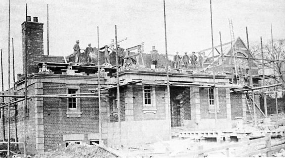
Bolsover Baths was built complete with a house for the superintendent. The facility is seen under construction in 1925.

They were opened in 1925 on land given to the miner’s welfare committee fund by the duke of Portland, at the bottom of Castle Lane. Not only were there public baths, but the scheme also included public slipper baths (where, for those who had no bathroom, you could go and get one) and showers. The baths (there was one pool) could be boarded over for dances, concerts and meetings.

Our first photograph shows the baths, including the superintendent’s house, under construction. Our second the completed baths, both are courtesy of Bernard Haigh and featured in his ‘Around Bolsover’ book. The baths were certainly impressive.  As recorded in our book ‘Bolsover: castle, town and colliery’ the town’s urban district council took a 25-year lease on the baths in 1925, at a nominal sum.

They were used by local people and those from further afield – particularly schools, who would be transported by the town’s Castle Coaches to and from the baths. (The writer of this post remembers being ferried from a Chesterfield area junior school to Bolsover and back in the late 1960s by Bolsover’s own Castle Coaches).

The interwar period was one of progress by Bolsover’s urban district council. They constructed council homes, provided improved parks, purchased the formerly private water undertaking (1923) and began to supply electricity (from 1927). A library was also established in the council offices, jointly with the county council, in 1925, before moving to a former Co-op branch in 1932, on Cotton Street.
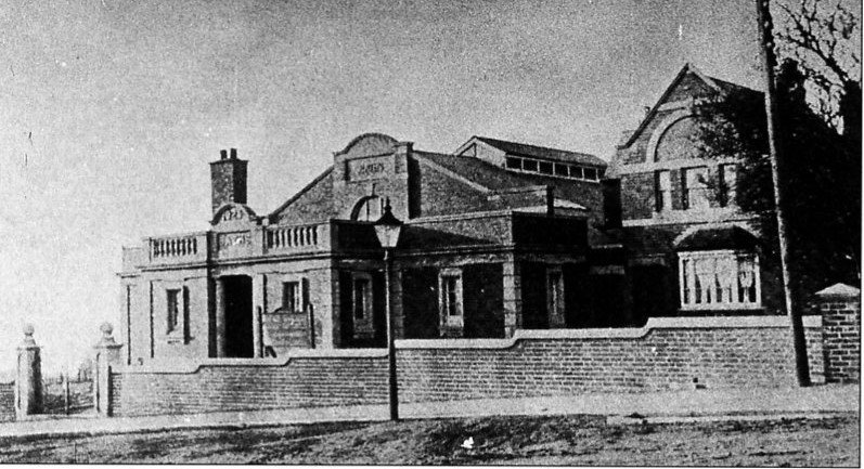
The completed Bolsover Baths in 1925. They were controversially demolished in the 1980s.

Bolsover baths Read More »

England’s Past for Everyone 2008 launch at Bolsover remembered

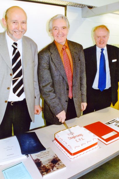
We’ve dipped in to our own archives for this blog, with pictures of when our part of the England’s Past for Everyone (EPE) project was launched in Bolsover Library on 18 March 2006.

Dennis Skinner, then Bolsover’s MP, with the co-authors of the two EPE books produced as part of the project – Dudley Fowkes (left) and Philip Riden (right).

We were able to welcome Dennis Skinner, then Bolsover MP, who cut our rather tasty birthday cake. Professor David Hey (who sadly died in 2016) and Professor John Beckett from the University of Nottingham and one-time Victoria County History (VCH) national director were also present along with civic and local history organisations in the Derbyshire project areas (which were Bolsover and Hardwick). Professor Hey was a chairman of the Derbyshire Victoria County History Trust.

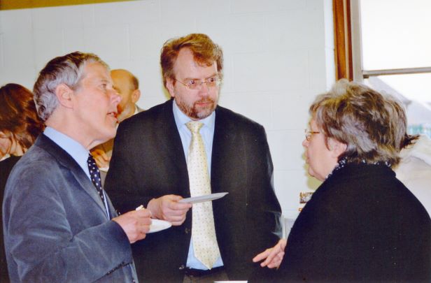
The much-missed Professor David Hey (right) is with Professor John Beckett (centre), talking to a member of one of the civic and local history societies invited to the project launch

The EPE project was driven by the internationally respected research standards of VCH. In addition to the two books on Bolsover and Hardwick which were eventually produced, a website was created. This is still accessible at https://www.victoriacountyhistory.ac.uk/explore/. The project included work with schools. A volunteer research group was started and contributed to the work. Other communities across England were also part of the EPE project.

Find out more about the Derbyshire EPE books on Bolsover and Hardwick (which are unfortunately now out of print) and other VCH publications here.

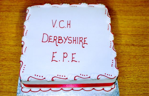
Our locally baked ‘birthday’ cake

England’s Past for Everyone 2008 launch at Bolsover remembered Read More »

Our approach to digital media

It’s only fairly recently that we have been managing our own digital media presence. Both our own webpage and Facebook page are newcomers.

We have had a blog published by the British Association for Local History (BALH), about this recent approach to digital media, including Facebook posts. Take a look at https://www.balh.org.uk/blog-opening-up-our-research-to…

The BALH has lots of information on its website (https://www.balh.org.uk/) for anyone interested in local history and runs a popular series of on-line talks and seminars.

Our approach to digital media Read More »

TP Wood’s Chesterfield and North Derbyshire Almanac

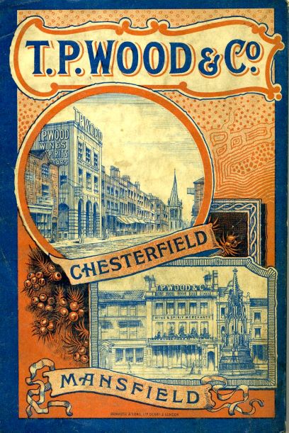
Local wine and spirit merchant Thomas Philpot Wood (1840-1911) published an annual almanac from his premises over-looking Chesterfield Market Place. Our first illustration shows the once familiar cover of one the later editions. The second illustration is taken from the rear cover of his edition for 1900, which clearly shows TP Wood’s premises. The almanac was distributed freely to his ‘customers and friends’.

A familiar cover design, which last appeared basically unaltered the last almanac for 1964, published at the end of 1963.

The first edition was published in 1863 with the final one in 1963 (for 1964), though by this time the business had long been part of the Mansfield Brewery Company. There were notable gaps in publication, including just before the First World War and after the Second World War.

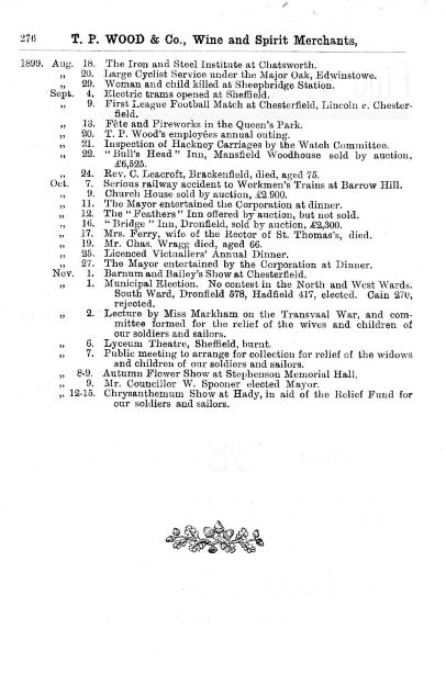
In its early years, Wood would introduce each almanac with his personal thoughts about local and national happenings. There were general articles, a local directory and perhaps, most famously of all, a chronicle in which local events were briefly listed. Our third photograph shows the final entries for the 1900 almanac. They generally end in November of each year to allow for typesetting and subsequent publication around Christmas. The almanac for 1900 was therefore published in the period leading up to Christmas 1899. It comprised some 515 pages – quite an undertaking. They were eagerly awaited in many households.

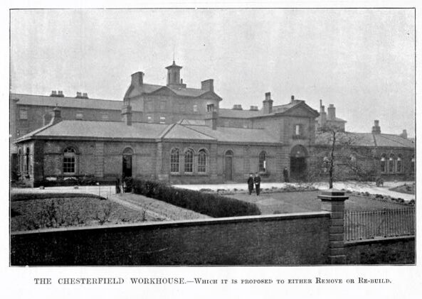
The almanacs might also be illustrated with plates of local features, such as the workhouse on Newbold Road (later Scarsdale Hospital) – our final photo. Wood explains in his introduction that rebuilding or a move out of town was then under discussion. In the event the former was pursued.

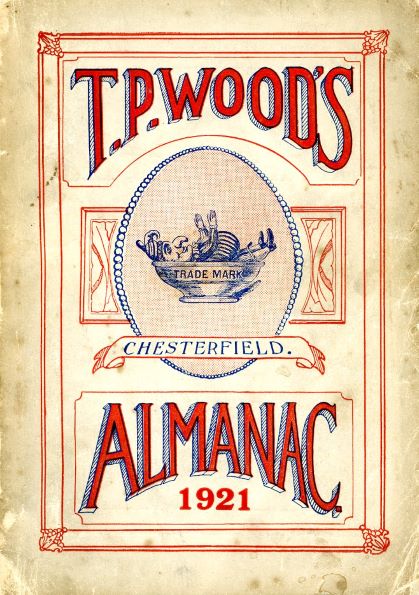
The covers of the almanac changed little in its later years. Our first photograph shows one from 1921, which includes the TP Wood’s punch (in a) bowl trademark. The cover of the last edition for 1964 was basically the same, but with a dark blue paper.

TP Wood himself was a great benefactor to the town and prominent in its politics. Today he is best remembered as the driving force behind Chesterfield’s Queen’s Park and his almanac. You can find out more about him at this short biography by Chesterfield Museum.

There’s an interesting blog from the Derbyshire Record Office about how an engraving of Chapman’s 1837 map appeared in one of TP Wood’s almanacs here.

For us in Derbyshire VCH, we still use TP Wood’s almanacs as a useful research source – particularly its chronicle of local events.

TP Wood’s Chesterfield and North Derbyshire Almanac Read More »

The Angel Hotel, Market Place, Chesterfield

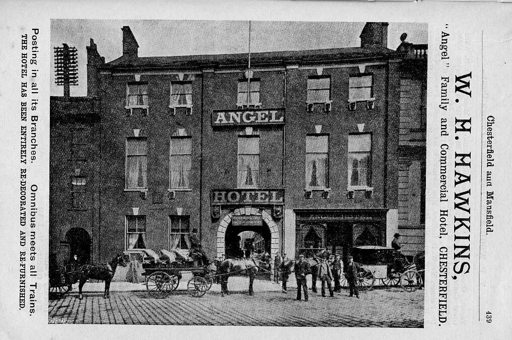
We are returning to Angel Yard, more particularly the Angel Hotel, for this post. Our illustration here is an advertisement taken from TP Wood’s Almanac for 1900. It shows the hotel sandwiched between the National Westminster Bank and the former post office – all opposite the Market Hall. The entrance to Angel Yard is through the central archway.

The Angel Hotel, Chesterfield Market Place. An advertisement from TP Wood’s Almanac for 1900.

John Hirst’s ‘Chesterfield Pubs’ (2005) tells the later story of the hotel, which, by the mid-19th century, had become one of the best in Chesterfield. He cites an 1890 commercial guide to Chesterfield which gives details of the accommodation – 20 bedrooms, billiard room with three tables, coffee room, dining room and commercial room. The ‘Oak Room’ was said to the finest dining and ballroom in the county. Of 60ft by 30ft it could seat 120 people. Stabling was available for 80 horses.

Our own ‘Chesterfield Streets and Houses’ book explains that the Angel Hotel took the name of an inn further east along High Street. This was possibly while other name changes for inns were taking place in the area in the 1790s. Until that time the Angel was called the Castle Inn. We also push the story back a little further – earlier into the 17th century – as we believe that the site was once owned by the one-time influential Clarke family.

In the early 1780s John Saxton was the landlord and also the Chesterfield postmaster. The Newcastle, Birmingham, Bristol and Bath coaches all called there. The coming of the railways from the 1840s reduced The Angel’s importance as a coating inn, but it was still regularly used for assemblies, auctions and stabling. It was, itself, sold in 1876 for £11,300 – a considerable sum at the time.

By the late 19th century, the Angel was owned by Sheffield brewers Wm. Stones Ltd. But, the Angel’s days were unfortunately numbered. Stones owned the nearby Hotel Portland, with its more modern accommodation. In 1915, deeming that the Angel was surplus to requirements, Wm Stones gave up the hotel’s licence. The Angel Vaults was, however, retained. This comprised two rooms, used as a public bar (on the right-hand side of the photograph), until 1920 when the licence was transferred to a new Angel Hotel on Derby Road (now Tesco).

Since 1915 the hotel had been used as a British Red Cross waste paper depot. A dramatic fire, on an icy February 1917 night, seriously damaged the hotel building, with water from the fire-fighting inundating the Vaults.

John Hirst states that the building was finally cleared in 1926 with an extension to the Westminster Bank and former Post Office covering most of the site. A small gap marks Angel Yard – the subject of our post of 21 February 2021.

There’s a good account of 17th century coaching inns in the town (including the Angel) in Rosemary Milward’s 1980 article in the Derbyshire Miscellany (pages 31-7), although by a slip of the pen, on page 31, the Angel is placed on the south side of the Market Place. You can read this free by following this link.

https://www.derbyshireas.org.uk/DM09-01.pdf

The Angel Hotel, Market Place, Chesterfield Read More »

Brampton draft updated

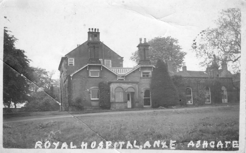
We are always pleased to receive comments on draft text posted on our website. Paul Freeman’s research about Brimington tied in with Ashgate Hospice’s former role as a Voluntary Aid Detachments (VAD) hospital in the First World War (for causalities in that war). Our photograph here may well show the property – Ashgate  House – during this period.

The postcard here may date from the time that the present Ashgate Hospice (formerly Ashgate House) was used as a VAD hospital during the First World War.

As is probabaly well-known, the Barnes family owned the property for some time. In 1915 the family offered the mansion to the Red Cross for use as a VAD hospital after Trinity Institute on Newbold Road (in Chesterfield), which had originally been taken over for the purpose, was declared full. The Ashgate hospital continued to receive wounded soldiers until it closed in March 1919, by which date 1,1015 men had been treated there and at Trinity Institute.

Thanks to Paul’s research and that of others, we have been able to update our draft text on Brampton to reflect this part of the former Ashgate House’s history. We still need to sketch in the later history, but will be doing so in the coming months. For example, after the Second World War, it became an annex, for rehabilitation, to the Chesterfield and North Derbyshire Royal Hospital on Holywell Street. In 1972 there were 45 beds there, some in a ‘Horsa’ building in the stable yard. Ashgate Hospice opened in 1988 using part of the former Ashgate House.

To find out more about the large parish of Brampton, which extended down Chatsworth Road to its border with Chesterfield, look at our draft text on Brampton at https://derbyshirevch.org/draft-text/. Look for the download on Brampton. Ashgate House is at page 60.

There’s also a short article on Ashgate House at https://northwingfield.wordpress.com/.

To find out more about VAD hospitals visit https://vad.redcross.org.uk/Auxiliary-Hospitals.

Brampton draft updated Read More »

What’s an angel doing in Saltergate?

One of the features of older Chesterfield was the large number of long yards in the Market Place area. In this post we look at one of these survivors – Angel Yard which started in the Market Place and ran right up to Saltergate.

When the Crown officials, who had charge of the manor of Chesterfield, decided to move to a new and present market area, at the end of the 12th century, they also laid out burgage plots. On the Low Pavement and Central Pavement side of the market these went right down to the banks of the river Hipper. But, on the opposite side they were constrained by those already on Saltergate. Many had yards to access the properties that were built on them.

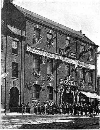
1) The Angel Hotel, Chesterfield Market Place. Pictured in 1892, decorated for the tuning of the first sod of the Lancashire, Derbyshire and East Coast Railway, the archway entrance led through to Angel Yard.

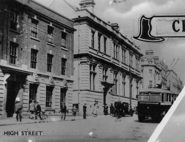
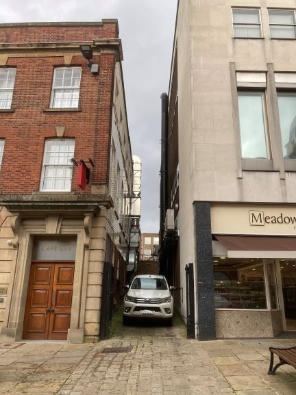
You can still see remnants of these plots and yards today. A traceable one is Angel Yard, which ran from the Angel Hotel on the Market Place, right up to Saltergate. Our first photograph shows the one-time Angel – decorated for the turning of the first sod of the Lancashire, Derbyshire and East Coast Railway in 1892. The archway to the right leads up to Angel Yard. Fast forward to the late 1920/1930s for our second photograph – complete with trolley bus. The Angel Hotel was burnt down in 1917, but had closed in 1915. The adjacent post office (which opened in 1886 after being in the Market Hall) took advantage by extending towards its next-door neighbour – the then Westminster Bank. Note the gap between the two – probably remnants of our Angel Yard. This gap is still there – our third photograph.

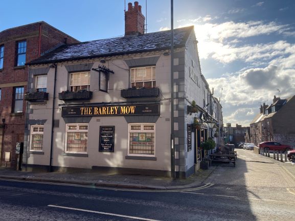
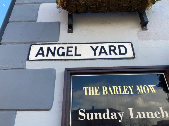
At Saltergate – our fourth photograph – next to the Barley Mow public house, Angel Yard still exists. You can still see it has a street name plate and it actually looks like a yard. It runs down towards its now isolated end in the Market Place, cut off by the relatively modern Rose Hill.

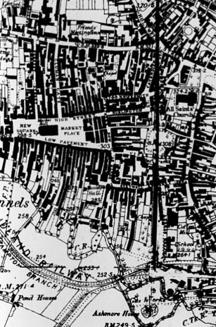
There are still other fragments of the burgage plots and their yards left – perhaps most notably on Central Pavement with Theatre Yard and Ward’s Yard. But many went when The Pavements shopping centre was developed at the rear of Low Pavement. A stark illustration of the former burgage plots can be seen on our seventh and final illustration – part of the 1883 Ordnance Survey 6 inches to 1 mile map of Chesterfield. Note the long black blocks of property – following the boundaries of the old burgage plots.

You can find out lots more in our Chesterfield Streets and Houses book.

2) After the Angel burnt down in 1917 (after being closed in 1915), the post office (left) extended over its site. But there’s a gap between the two properties which is probably the entrance to Angel Yard. Note the single-decker trolley bus – the Chesterfield system was in operation from 1927 until 1938.
3) That gap is still here, but now ends a little beyond the parked car.
4) Back up the hill at the Saltergate end – Angel Yard is still very much extant – starting at the Barley Mow public house – it still includes housing.
5) Angel Yard sign on the side of the Barley Mow public house, Saltergate.
6) The long former burgage plots can easily be seen on this 1883 Ordnance Survey map. In the Low and Central Pavements area they run right down to the river Hipper. Angel Yard starts from just above the ‘e’ in ‘Market Hall’. on its way up the Saltergate.

What’s an angel doing in Saltergate? Read More »

New Bolsover and Newcastle’s famous department store

There’s a tenuous link between New Bolsover and a famous department store.

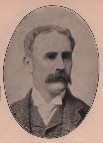
It was Emerson Muschamp Bainbridge, (1845-1911) at whose behest New Bolsover model village was constructed for the Bolsover Colliery Company, in the 1890s. As managing director of the company, he tried to ensure that his worker’s conditions were improved with such developments as New Bolsover and later Creswell. His Father, also Emerson Muschamp (1817-1892), created and owned the famous Bainbridge department store in Newcastle-Upon-Tyne, credited with being the first such store of its kind. It’s still open, though not on its original site and is now part of the John Lewis Partnership.

Emmerson Bainbridge (junior), who followed in the family tradition of improving conditions for his workers by creating New Bolsover.

Bainbridge junior must have taken note of his father’s actions towards his employees. Just as in New Bolsover; at Newcastle, Bainbridge senior improved the conditions of his employees. Though conditions were harsh, many of the staff lived in a well-furnished hostel nearby. The picture here is taken from The Black and White Parliamentary Album of 1895 – when our Emmerson M Bainbridge (junior) was MP for Gainsborough. (Source: https://ia800305.us.archive.org/34/items/blackwhiteparli00compgoog/blackwhiteparli00compgoog.pdf) Find a more in our ‘snippets’ article.

New Bolsover and Newcastle’s famous department store Read More »

Whittington – the start of our draft text postings

We have started to add some draft text to our website, starting with Whittington (and Brampton), both near Chesterfield.

The former township and later civil parish of Whittington, Chesterfield, is a diverse one of some 1,581 acres. The former township of Brampton occupied about 7,900 acres. They are very much work in progress, but take a look here https://derbyshirevch.org/draft-text/. We’d be grateful for comments, additions or corrections.

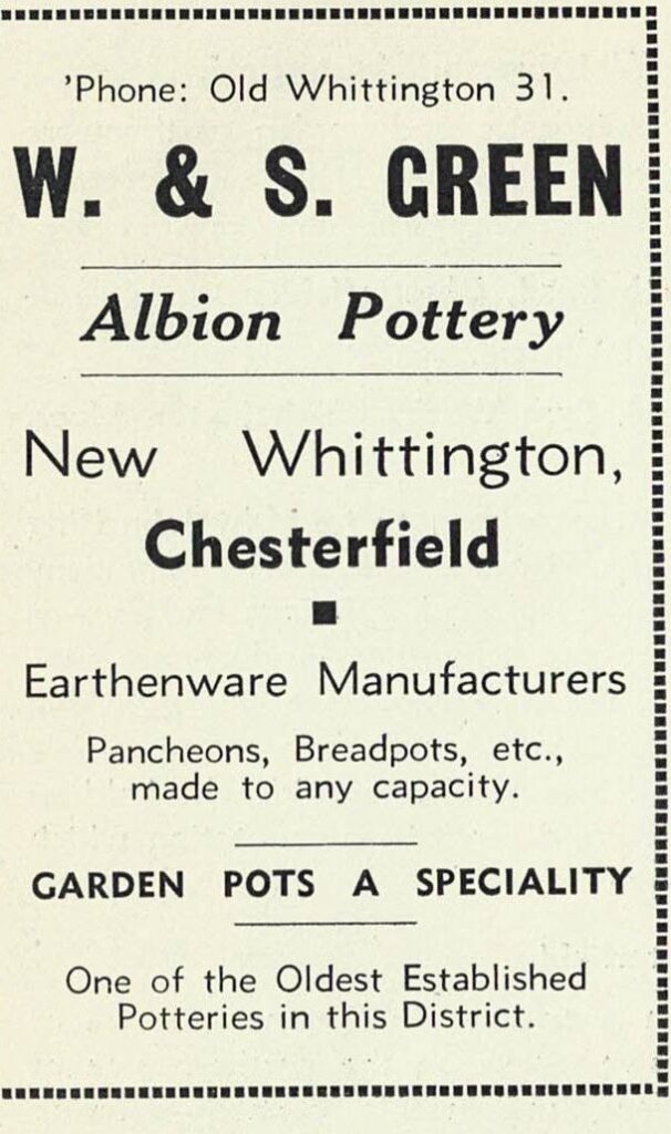
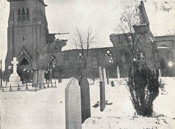
For Whittington you’ll find information on manorial history, education and some of the economic history chapter. The Albion Pottery (as advertised here in about 1938) is covered, but the larger Pearson’s Pottery isn’t. It is actually in Newbold parish – as we explain. We also include an account of Frith’s works at New Whittington, responsible for a fair part of the growth of this community. Other industry, including mining, is also covered. Representing text to come is a contemporary photograph of the devastation caused to the 1863 parish church, in a January 1895 fire. It was rebuilt – the new 1896 building still stands today.

Whittington – the start of our draft text postings Read More »

Chesterfield Bowling Green

We are back to Chesterfield for this posting – more from our ‘Chesterfield Streets and Houses’ book.

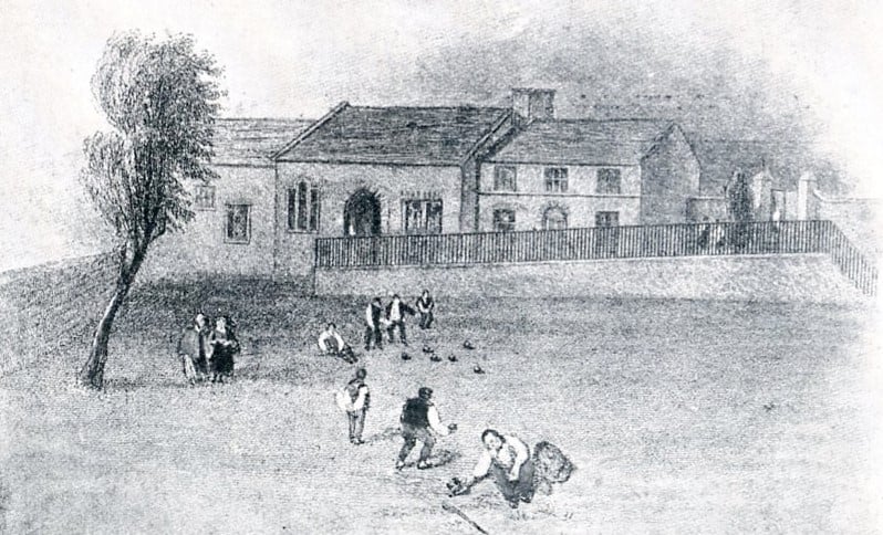
Time for a game of bowls? It’s often been said (and written) that the bowling green off South Place and New Beetwell Street, Chesterfield, dates from 1294, but there’s no evidence for this. It is, though, one of the oldest in the country still in use – it was first mentioned in 1651. It’s seen here in an engraving from Ford’s 1839 ‘History of Chesterfield…’ The building behind is the old Guild Hall, demolished and replaced in the late 1840s, by a new building – itself now demolished.

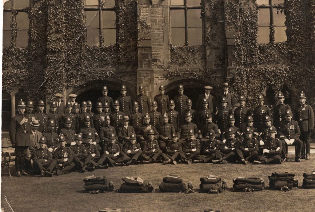
Our second illustration shows the Chesterfield Borough Police Force on the bowling green, outside the 1840s replacement Municipal Hall, for the annual inspection of equipment. At one time the hall acted as offices, courthouse and police station.

Posted 26 January 2021

Chesterfield Bowling Green Read More »