Webmaster, Derbyshire VCH Trust

Brampton draft updated

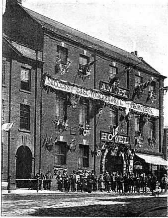
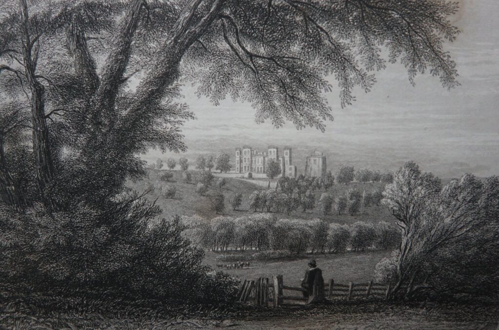
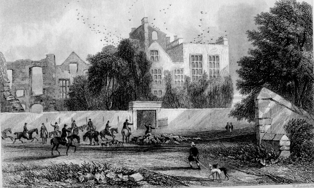
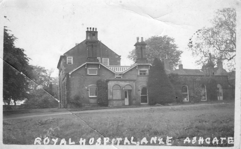
We are always pleased to receive comments on draft text posted on our website. Paul Freeman’s research about Brimington tied in with Ashgate Hospice’s former role as a Voluntary Aid Detachments (VAD) hospital in the First World War (for causalities in that war). Our photograph here may well show the property – Ashgate  House – during this period.

The postcard here may date from the time that the present Ashgate Hospice (formerly Ashgate House) was used as a VAD hospital during the First World War.

As is probabaly well-known, the Barnes family owned the property for some time. In 1915 the family offered the mansion to the Red Cross for use as a VAD hospital after Trinity Institute on Newbold Road (in Chesterfield), which had originally been taken over for the purpose, was declared full. The Ashgate hospital continued to receive wounded soldiers until it closed in March 1919, by which date 1,1015 men had been treated there and at Trinity Institute.

Thanks to Paul’s research and that of others, we have been able to update our draft text on Brampton to reflect this part of the former Ashgate House’s history. We still need to sketch in the later history, but will be doing so in the coming months. For example, after the Second World War, it became an annex, for rehabilitation, to the Chesterfield and North Derbyshire Royal Hospital on Holywell Street. In 1972 there were 45 beds there, some in a ‘Horsa’ building in the stable yard. Ashgate Hospice opened in 1988 using part of the former Ashgate House.

To find out more about the large parish of Brampton, which extended down Chatsworth Road to its border with Chesterfield, look at our draft text on Brampton at https://derbyshirevch.org/draft-text/. Look for the download on Brampton. Ashgate House is at page 60.

There’s also a short article on Ashgate House at https://northwingfield.wordpress.com/.

To find out more about VAD hospitals visit https://vad.redcross.org.uk/Auxiliary-Hospitals.

Brampton draft updated Read More »

What’s an angel doing in Saltergate?

One of the features of older Chesterfield was the large number of long yards in the Market Place area. In this post we look at one of these survivors – Angel Yard which started in the Market Place and ran right up to Saltergate.

When the Crown officials, who had charge of the manor of Chesterfield, decided to move to a new and present market area, at the end of the 12th century, they also laid out burgage plots. On the Low Pavement and Central Pavement side of the market these went right down to the banks of the river Hipper. But, on the opposite side they were constrained by those already on Saltergate. Many had yards to access the properties that were built on them.

1) The Angel Hotel, Chesterfield Market Place. Pictured in 1892, decorated for the tuning of the first sod of the Lancashire, Derbyshire and East Coast Railway, the archway entrance led through to Angel Yard.

You can still see remnants of these plots and yards today. A traceable one is Angel Yard, which ran from the Angel Hotel on the Market Place, right up to Saltergate. Our first photograph shows the one-time Angel – decorated for the turning of the first sod of the Lancashire, Derbyshire and East Coast Railway in 1892. The archway to the right leads up to Angel Yard. Fast forward to the late 1920/1930s for our second photograph – complete with trolley bus. The Angel Hotel was burnt down in 1917, but had closed in 1915. The adjacent post office (which opened in 1886 after being in the Market Hall) took advantage by extending towards its next-door neighbour – the then Westminster Bank. Note the gap between the two – probably remnants of our Angel Yard. This gap is still there – our third photograph.

At Saltergate – our fourth photograph – next to the Barley Mow public house, Angel Yard still exists. You can still see it has a street name plate and it actually looks like a yard. It runs down towards its now isolated end in the Market Place, cut off by the relatively modern Rose Hill.

There are still other fragments of the burgage plots and their yards left – perhaps most notably on Central Pavement with Theatre Yard and Ward’s Yard. But many went when The Pavements shopping centre was developed at the rear of Low Pavement. A stark illustration of the former burgage plots can be seen on our seventh and final illustration – part of the 1883 Ordnance Survey 6 inches to 1 mile map of Chesterfield. Note the long black blocks of property – following the boundaries of the old burgage plots.

You can find out lots more in our Chesterfield Streets and Houses book.

2) After the Angel burnt down in 1917 (after being closed in 1915), the post office (left) extended over its site. But there’s a gap between the two properties which is probably the entrance to Angel Yard. Note the single-decker trolley bus – the Chesterfield system was in operation from 1927 until 1938.
3) That gap is still here, but now ends a little beyond the parked car.
4) Back up the hill at the Saltergate end – Angel Yard is still very much extant – starting at the Barley Mow public house – it still includes housing.
5) Angel Yard sign on the side of the Barley Mow public house, Saltergate.
6) The long former burgage plots can easily be seen on this 1883 Ordnance Survey map. In the Low and Central Pavements area they run right down to the river Hipper. Angel Yard starts from just above the ‘e’ in ‘Market Hall’. on its way up the Saltergate.

What’s an angel doing in Saltergate? Read More »

New Bolsover and Newcastle’s famous department store

There’s a tenuous link between New Bolsover and a famous department store.

It was Emerson Muschamp Bainbridge, (1845-1911) at whose behest New Bolsover model village was constructed for the Bolsover Colliery Company, in the 1890s. As managing director of the company, he tried to ensure that his worker’s conditions were improved with such developments as New Bolsover and later Creswell. His Father, also Emerson Muschamp (1817-1892), created and owned the famous Bainbridge department store in Newcastle-Upon-Tyne, credited with being the first such store of its kind. It’s still open, though not on its original site and is now part of the John Lewis Partnership.

Emmerson Bainbridge (junior), who followed in the family tradition of improving conditions for his workers by creating New Bolsover.

Bainbridge junior must have taken note of his father’s actions towards his employees. Just as in New Bolsover; at Newcastle, Bainbridge senior improved the conditions of his employees. Though conditions were harsh, many of the staff lived in a well-furnished hostel nearby. The picture here is taken from The Black and White Parliamentary Album of 1895 – when our Emmerson M Bainbridge (junior) was MP for Gainsborough. (Source: https://ia800305.us.archive.org/34/items/blackwhiteparli00compgoog/blackwhiteparli00compgoog.pdf) Find a more in our ‘snippets’ article.

New Bolsover and Newcastle’s famous department store Read More »

Whittington – the start of our draft text postings

We have started to add some draft text to our website, starting with Whittington (and Brampton), both near Chesterfield.

The former township and later civil parish of Whittington, Chesterfield, is a diverse one of some 1,581 acres. The former township of Brampton occupied about 7,900 acres. They are very much work in progress, but take a look here https://derbyshirevch.org/draft-text/. We’d be grateful for comments, additions or corrections.

For Whittington you’ll find information on manorial history, education and some of the economic history chapter. The Albion Pottery (as advertised here in about 1938) is covered, but the larger Pearson’s Pottery isn’t. It is actually in Newbold parish – as we explain. We also include an account of Frith’s works at New Whittington, responsible for a fair part of the growth of this community. Other industry, including mining, is also covered. Representing text to come is a contemporary photograph of the devastation caused to the 1863 parish church, in a January 1895 fire. It was rebuilt – the new 1896 building still stands today.

Whittington – the start of our draft text postings Read More »

Chesterfield Bowling Green

We are back to Chesterfield for this posting – more from our ‘Chesterfield Streets and Houses’ book.

Time for a game of bowls? It’s often been said (and written) that the bowling green off South Place and New Beetwell Street, Chesterfield, dates from 1294, but there’s no evidence for this. It is, though, one of the oldest in the country still in use – it was first mentioned in 1651. It’s seen here in an engraving from Ford’s 1839 ‘History of Chesterfield…’ The building behind is the old Guild Hall, demolished and replaced in the late 1840s, by a new building – itself now demolished.

Our second illustration shows the Chesterfield Borough Police Force on the bowling green, outside the 1840s replacement Municipal Hall, for the annual inspection of equipment. At one time the hall acted as offices, courthouse and police station.

Posted 26 January 2021

Chesterfield Bowling Green Read More »

Hasland Locomotive Sheds

Hasland Locomotive sheds were a bit of a sticking point when Chesterfield wanted to extend its boundaries in the 1920s. Hasland parish council were concerned about loss of rates. Our photographic panorama here, from 3 July 1960, is of the shed, using a number of photos, pieced together and retouched, all by the late Chris Hollis, who was a fireman there.

The roof was progressively removed from the 1950s due to subsidence. The sheds, originally built by the Midland Railway, opened in 1875 and closed in October 1964.

Until 19th-century boundary changes, the township (later civil parish) of Hasland included not just what people think of as Hasland today but also Corbriggs and Winsick, Grassmoor, Birdholme and the St Augustine’s end of Boythorpe.

This year, we’re hoping to publish a history of Hasland, near Chesterfield. This will be the first authoritative account of the community.

We’ll tell the story of how the separation happened and of the communities comprising the historic parish of Hasland. The book will include the combined efforts of many hours of work by our Chesterfield volunteer research group and by our VCH county editor Philip Riden.

Hasland Locomotive Sheds Read More »

Shuttlewood schools complex

Part of the former Shuttlewoood schools complex on Clowne Road (B6418) near Bolsover – pictured in our first and second photographs – is to be demolished. This is the northern part of the site – the southern part is occupied by the present Brockley Primary and Nursery School, (our third photograph) which is not affected. This southern part (opened in 1927) is listed grade II – as a good example of the work of ground-breaking Derbyshire Education Committee architect GH Widows.

Shuttlewood Schools (northern part of the complex).

The northern part is not listed and not by Widdows – it originally dates from 1907 and was first used as an infant school. In 1933 (when it was extended) it became a senior school, but latterly it had not been used for teaching (since 2007). The 1927 southern building became a junior and infant school.

The northern building has been surveyed. Copies of this can be viewed on the Bolsover District Council’s planning portal, along with heritage assessments. https://publicaccess.bolsover.gov.uk/online-applications/

Brockley Primary and Nursery School.

We have lots more on education in Bolsover, including Shuttlewood, in our VCH volume III – ‘Bolsover and adjoining parishes’, in our Explore paperback and on our website https://www.victoriacountyhistory.ac.uk/…/education-bolsover

Shuttlewood schools complex Read More »

Bess of Hardwick

When was Bess of Hardwick born? Our county editor thinks it was sometime between 13 February 1521 and 12 February 1522, not as some others have it.

Twenty-twenty one probably marked an important anniversary for Bess of Hardwick – it’s almost certain that it was 500 years since she was born.

Bess is probably the third most famous Englishwoman of her age after Queen Elizabeth and Mary Queen of Scots. Bess is, of course, particularly, associated with Hardwick Hall.

Though there’s no shortage of books on Bess of Hardwick, there has been some conjecture, over a long period, on just when she was born. Our VCH county editor, Philip Riden, who has extensively researched the issue, is certain that she was born in 1521 or in the early months of 1522.

Philip has written about the Hardwick family at Hardwick Hall in the Derbyshire Archaeological Society’s Journal (DAJ) of 2010. You can read it by selecting the article from the contents page here:
https://archaeologydataservice.ac.uk/…/vi…/daj/contents.cfm…

You can directly download the article as pdf via the link here. Look for the final paragraph on page 150.

You can find out more about Bess and the Hardwick estate in our paperback book ‘Hardwick a great house and its estate’.

The rather romanticised engraving of the Hardwick Hall is taken from Ford’s History of Chesterfield, published in 1839, as is the second illustration of Hardwick Old Hall.

This post was revised on 5 August 2023 to remove a link to website that no longer exists and add a direct link to an article in the DAJ.

Bess of Hardwick Read More »

January 2021 – Welcome to our new website

For the start of this new year and new decade we have now made our first foray into the world of online; previously we have been happy to be hosted under the umbrella of the IHR website, in turn managed by the School of Advanced Study, part of the University of London. However, recent changes to that arrangement have meant that we have lost the ability to manage and maintain our own area on that site. Hence, now we find ourselves here with a brand new website.

The added complications of the Covid-19 Pandemic have meant that our regular classes and meetings have had to be suspended, so, like so many other societies and local history groups, we have had to move online to keep in touch with our loyal supporters.

January 2021 – Welcome to our new website Read More »